Greg James

Eastern Eyre Peninsula


Greg James' Fishing Pathfinder - GPS Marks for Eastern Eyre Peninsula
Sunken Vessel Aunties Granma's Plonkas Lonely Twins Triplets Slippers Bioz Bandies Oscars Jackies Nagez Arnies Callme Choppoz Blagduk

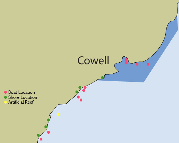
Boat Fishing Locations

Name:
GPS:
Fish:

Arnies
34°11'40"S, 136°18'33"E
whiting, red mullet

Name:
GPS:
Fish:

Nagez
34°11'19"S, 136°19'23"E
snapper, sweep, trevalley

Name:
GPS:
Fish:

Jackies
33°57'04"S, 136°34'20"E
whiting, squid, tommies

Name:
GPS:
Fish:

Oscars
33°57'12"S, 136°35'18"E
snapper, whiting

Name:
GPS:
Fish:

Bandies
33°56'16"S, 136°35'26"E
whiting

Name:
GPS:
Fish:

Bioz
33°42'11"S, 136°58'30"E
monster whiting, squid, blue crabs

Name:
GPS:
Fish:

Slippers
33°43'10"S, 136°58'36"E
snook, tommies, blue crabs

Name:
GPS:
Fish:

Callme
33°54'45"S, 136°35'22"E
whiting, snapper, trevalley

Name:
GPS:
Fish:

Choppoz
33°42'51"S, 137°03'16"E
red mullet, whiting, tommies, blueys, garfish, snook

Name:
GPS:
Fish:

Blagduk
33°42'46"S, 137°08'18"E
whiting, snook, garfish, blueys, flathead

Name:

GPS:
Fish:

TB1
(not on map, off Tumby Bay)
34°24'17"S, 136°08'39"E
garfish, whiting, red mullet, tommies, snook

Name:

GPS:
Fish:

TB2
(not on map, off Tumby Bay)
34°24'20"S, 136°08'43"E
garfish, whiting, red mullet, tommies, snook

Name:

GPS:
Fish:

Undies
(not on map, off Tumby Bay)
34°24'19"S, 136°09'24"E
whiting, salmon trout, tommies, snook, red mullet

Name:

GPS:
Fish:

Flyteez
(not on map, off Tumby Bay)
34°24'45"S, 136°08'36"E
snapper, trevalley, big whiting, leatherjackets

Name:

GPS:
Fish:

Snakes
(not on map, off Tumby Bay)
34°24'16"S, 136°09'13"E
whiting, garfish, small snapper, nannys


Shore Fishing Locations

Name:
GPS:
Fish:

Triplets
34°11'32"S, 136°18'30"E
salmon, mullet

Name:
GPS:
Fish

Twins
34°09'02"S, 136°19'59"E
yellowin whiting, mullet, flathead, salmon trout

Name:
GPS:
Fish

Lonely
34°08'32"S, 136°20'17"E
yellowfin whiting, mullet, flathead, salmon trout

Name:
GPS:
Fish:

Plonkas
33°57'21"S, 136°33'13"E
salmon

Name:
GPS:
Fish

Granmas
33°54'07"S, 136°35'30"E
flounder, flathead

Name:
GPS:
Fish:

Aunties
33°49'53"S, 136°46'43"E
garfish, salmon trout, flounder


Artificial Reefs

Type:
GPS:
Fish:

Sunken vessel
34°06'36.94"S, 136°22'41.09"E
whiting, snapper, red mullet, squid, tommies, salmon